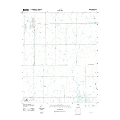
2012 Map of Morris
USGS Topo · Published 2012About this map
Morris stands at the center of this Okmulgee County landscape, where the prairie grid meets a network of creeks and small reservoirs. The map documents several significant burial grounds, including the large Morris Cem south of town, the Sacred Heart Cem near Grayson, and a secluded Indian Cem on the eastern edge of the quadrangle. These sites, along with small communities like Hitchita and Eram, reflect the deep-rooted settlement patterns of the region.
Find a feature on this map
49 named features on this map. Tap any name to fly to it.
Don’t see what you’re looking for? This feature index may not catch every label — zoom into the map to look around manually.
Map Details
Editions of this 2012 Morris Map
This is the sole edition of this map. No revisions or reprints were ever made.
Other maps of this area

1896 · Okmulgee
USGS Topo · 1:125,000

1900 · Canadian
USGS Topo · 1:125,000

1900 · Okmulgee
USGS Topo · 1:125,000

1946 · Fort Smith
USGS Topo · 1:250,000

1962 · Henryetta
USGS Topo · 1:24,000

1962 · Pierce
USGS Topo · 1:24,000

1962 · Hoffman
USGS Topo · 1:24,000

1965 · Fort Smith
USGS Topo · 1:250,000

1967 · Fort Smith
USGS Topo · 1:250,000
1970 · Council Hill
USGS Topo · 1:24,000