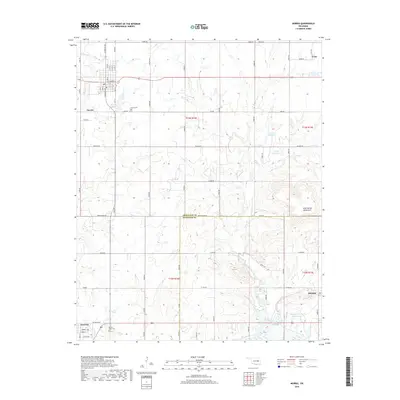
2018 Map of Morris
USGS Topo · Published 2018About this map
The town of Morris serves as the primary hub in this portion of eastern Oklahoma, where the street grid transitions into a vast network of section-line roads. The landscape is defined by the Okmulgee Co and Mcintosh Co boundary, which cuts through a region of scattered reservoirs and winding waterways. Water management is a visible priority here, seen in features like 111075 Reservoir, 111076 Reservoir, and the Sallisaw Cr Site 34 Reservoir near Hitchita.
Find a feature on this map
49 named features on this map. Tap any name to fly to it.
Don’t see what you’re looking for? This feature index may not catch every label — zoom into the map to look around manually.
Map Details
Editions of this 2018 Morris Map
This is the sole edition of this map. No revisions or reprints were ever made.
Other maps of this area

1896 · Okmulgee
USGS Topo · 1:125,000

1900 · Canadian
USGS Topo · 1:125,000

1900 · Okmulgee
USGS Topo · 1:125,000

1946 · Fort Smith
USGS Topo · 1:250,000

1962 · Henryetta
USGS Topo · 1:24,000

1962 · Pierce
USGS Topo · 1:24,000

1962 · Hoffman
USGS Topo · 1:24,000

1965 · Fort Smith
USGS Topo · 1:250,000

1967 · Fort Smith
USGS Topo · 1:250,000
1970 · Council Hill
USGS Topo · 1:24,000