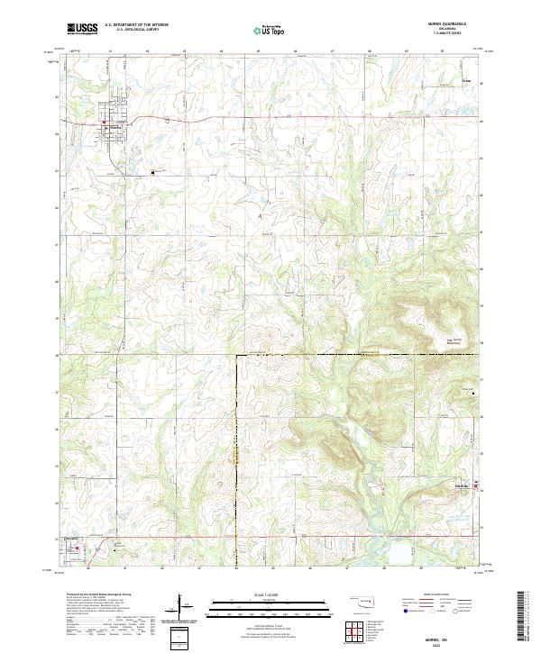
2022 Map of Morris
USGS Topo · Published 2022About this map
Morris stands as the primary hub in this eastern Oklahoma landscape, where the grid of city streets like Jefferson St and S Hughes Ave meets the surrounding rural section lines. The map reveals a transition from the structured town life of Morris and smaller communities like Grayson and Eram to the natural elevations of the High Spring Mountains. Local history is deeply etched into the land through numerous burial sites, including the Morris Cem, Indian Cem, and the Sacred Heart Cem near Grayson. This 2022 survey documents the complex water management of the region, featuring named drainages such as Cussetah Cr and Moore Cr, alongside engineered features like the Sallisaw Cr Site 24 Reservoir. The crossing of the Okmulgee and McIntosh county line provides a clear jurisdictional boundary through this mix of agricultural plains and high ground.
Find a feature on this map
70 named features on this map. Tap any name to fly to it.
Don’t see what you’re looking for? This feature index may not catch every label — zoom into the map to look around manually.
Map Details
Editions of this 2022 Morris Map
This is the sole edition of this map. No revisions or reprints were ever made.
Other maps of this area

1896 · Okmulgee
USGS Topo · 1:125,000

1900 · Canadian
USGS Topo · 1:125,000

1900 · Okmulgee
USGS Topo · 1:125,000

1946 · Fort Smith
USGS Topo · 1:250,000

1962 · Henryetta
USGS Topo · 1:24,000

1962 · Pierce
USGS Topo · 1:24,000

1962 · Hoffman
USGS Topo · 1:24,000

1965 · Fort Smith
USGS Topo · 1:250,000

1967 · Fort Smith
USGS Topo · 1:250,000
1970 · Council Hill
USGS Topo · 1:24,000