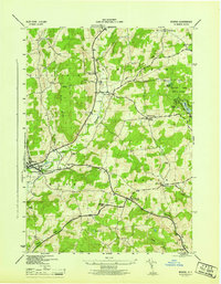
1945 Map of Morris
USGS Topo · Published 1945About this map
Butternut Creek winds through a landscape defined by small valley settlements and upland family farms in this mid-century survey of western Otsego County. The village of Morris serves as a primary hub, while rural life is anchored by a network of numbered schoolhouses and country churches, such as the Old Church east of the Hillington Cem. The presence of several family-named burial grounds, including the Bennett Weatherly Cem and Chapin Cem, provides significant geographic markers for genealogists tracing local lineage.
Find a feature on this map
42 named features on this map. Tap any name to fly to it.
Don’t see what you’re looking for? This feature index may not catch every label — zoom into the map to look around manually.
Map Details
Editions of this 1945 Morris Map
This is the sole edition of this map. No revisions or reprints were ever made.
Other maps of this area

1910 · Hartwick
USGS Topo · 1:62,500

1910 · New Berlin
USGS Topo · 1:62,500

1912 · New Berlin
USGS Topo · 1:62,500

1912 · Hartwick
USGS Topo · 1:62,500

1915 · Oneonta
USGS Topo · 1:62,500

1915 · Unadilla
USGS Topo · 1:62,500

1918 · Unadilla
USGS Topo · 1:62,500

1918 · Oneonta
USGS Topo · 1:62,500

1943 · Mt Vision
USGS Topo · 1:24,000

1943 · New Berlin North
USGS Topo · 1:24,000