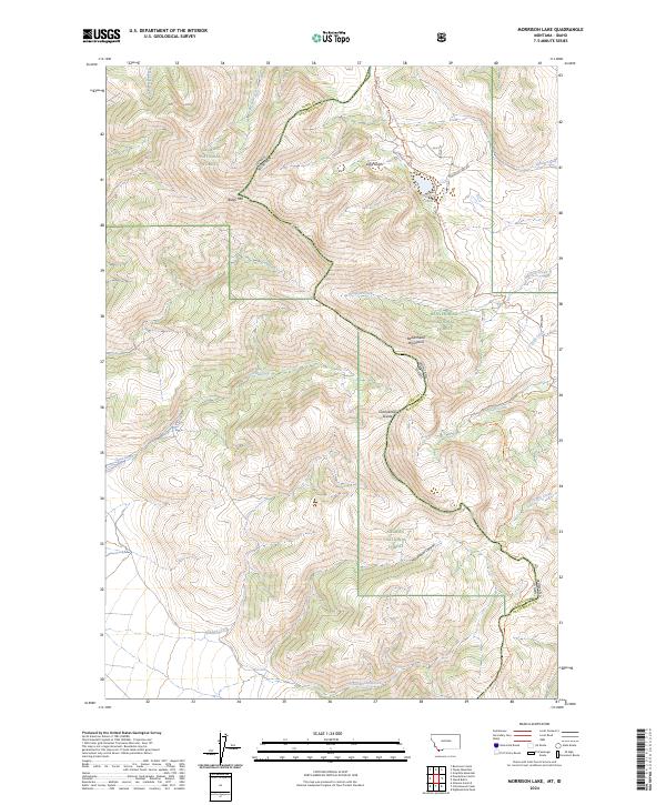
2024 Map of Morrison Lake
USGS Topo · Published 2024About this map
The Beaverhead Mountains form a dramatic backdrop for the high-altitude landscape where Montana and Idaho meet along the Continental Divide. This 2024 survey documents the rugged intersection of the Salmon National Forest and Beaverhead National Forest, a region defined by steep drainages and prominent peaks like Baldy Mtn. The watershed is carved by numerous seasonal and perennial flows, including Tenmile Creek, Clear Creek, and Wheeler Creek, all of which feed into the larger river systems of the Northern Rockies.
Find a feature on this map
38 named features on this map. Tap any name to fly to it.
Don’t see what you’re looking for? This feature index may not catch every label — zoom into the map to look around manually.
Map Details
Editions of this 2024 Morrison Lake Map
This is the sole edition of this map. No revisions or reprints were ever made.
Other maps of this area

1955 · Dubois
USGS Topo · 1:250,000

1956 · Morrison Lake
USGS Topo · 1:62,500

1956 · Nicholia
USGS Topo · 1:62,500

1957 · Scott Peak
USGS Topo · 1:62,500

1958 · Dubois
USGS Topo · 1:250,000

1965 · Graphite Mountain
USGS Topo · 1:24,000

1965 · Island Butte
USGS Topo · 1:24,000

1980 · Leadore
USGS Topo · 1:100,000

1983 · Dubois
USGS Topo · 1:100,000
1987 · Eighteenmile Peak
USGS Topo · 1:24,000