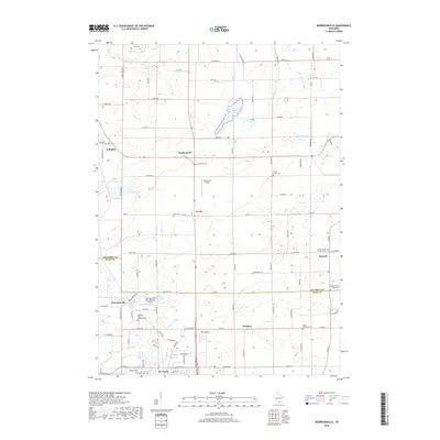
2018 Map of Morrisonville
USGS Topo · Published 2018About this map
Arlington and De Forest anchor the western and southern boundaries of this rural Wisconsin landscape, where the agricultural character of Columbia and Dane counties is clearly defined. The terrain is marked by the meandering paths of the Yahara River and the Crawfish River, which drains the northeastern corner. Significant marshlands such as Schoeneberg Marsh and water bodies like Goose Lake interrupt the grid of section lines and country roads. Small settlements including Morrisonville, Leeds, and Keyeser are interconnected by a network of county highways. Of particular interest are the multiple local airfields, including Morrisonville International Airport and Del Monte Airport, which suggest a specialized infrastructure for this farming region. The map also documents numerous local burial sites, such as Greenwood Cem and Leeds Center Cem, providing a dense record of family history and early community centers.
Find a feature on this map
57 named features on this map. Tap any name to fly to it.
Don’t see what you’re looking for? This feature index may not catch every label — zoom into the map to look around manually.
Map Details
Editions of this 2018 Morrisonville Map
This is the sole edition of this map. No revisions or reprints were ever made.
Other maps of this area

1890 · Madison
USGS Topo · 1:62,500

1890 · Sun Prairie
USGS Topo · 1:62,500

1892 · Madison
USGS Topo · 1:62,500

1896 · Sun Prairie
USGS Topo · 1:62,500

1901 · Poynette
USGS Topo · 1:62,500

1904 · Madison
USGS Topo · 1:62,500

1905 · Sun Prairie
USGS Topo · 1:62,500

1906 · Madison
USGS Topo · 1:62,500

1907 · Sun Prairie
USGS Topo · 1:62,500

1955 · Columbus
USGS Topo · 1:62,500