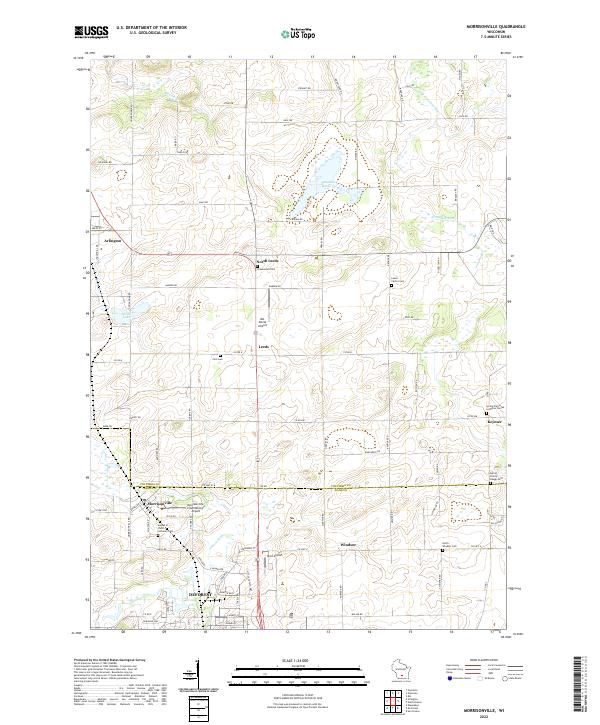
2022 Map of Morrisonville
USGS Topo · Published 2022About this map
Schoeneberg Marsh and the surrounding agricultural uplands of southern Columbia County define this landscape, where the headwaters of the Yahara River and the Crawfish River systems diverge. The settlement pattern is characterized by small unincorporated hamlets such as Leeds, North Leeds, and Keyeser, many of which grew around early rural crossroads. Genealogists will find a high density of preserved community sites, particularly religious burial grounds like the Spring Prairie Lutheran Cem and United in Christ Lutheran Cem near Morrisonville. The map also captures a cluster of localized aviation history through small airstrips like Del Monte Airport and Elert Airport, reflecting the region's mid-century shift toward private and agricultural flight. Further south, the encroaching suburban boundary of DeForest and the residential core of Windsor signal the transition from dairy land to the expanding Madison metropolitan periphery.
Find a feature on this map
96 named features on this map. Tap any name to fly to it.
Don’t see what you’re looking for? This feature index may not catch every label — zoom into the map to look around manually.
Map Details
Editions of this 2022 Morrisonville Map
This is the sole edition of this map. No revisions or reprints were ever made.
Other maps of this area

1890 · Madison
USGS Topo · 1:62,500

1890 · Sun Prairie
USGS Topo · 1:62,500

1892 · Madison
USGS Topo · 1:62,500

1896 · Sun Prairie
USGS Topo · 1:62,500

1901 · Poynette
USGS Topo · 1:62,500

1904 · Madison
USGS Topo · 1:62,500

1905 · Sun Prairie
USGS Topo · 1:62,500

1906 · Madison
USGS Topo · 1:62,500

1907 · Sun Prairie
USGS Topo · 1:62,500

1955 · Columbus
USGS Topo · 1:62,500