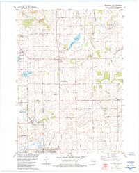
1984 Map of Morrisonville
USGS Topo · Published 1984About this map
Agricultural life in central Wisconsin is documented in this 1980s-era study, where the Chicago Milwaukee St Paul and Pacific rail line bisects a landscape defined by small hamlets and family-named roads. The map highlights the transition from the wet terrain of Schoenberg Marsh and Goose Lake to the cultivated fields of Leeds and Windsor townships. Several rural centers such as Arlington, North Leeds, and Keyeser appear as anchors for the surrounding farmsteads.
Find a feature on this map
45 named features on this map. Tap any name to fly to it.
Don’t see what you’re looking for? This feature index may not catch every label — zoom into the map to look around manually.
Map Details
Editions of this 1984 Morrisonville Map
This is the sole edition of this map. No revisions or reprints were ever made.
Other maps of this area

1890 · Madison
USGS Topo · 1:62,500

1890 · Sun Prairie
USGS Topo · 1:62,500

1892 · Madison
USGS Topo · 1:62,500

1896 · Sun Prairie
USGS Topo · 1:62,500

1901 · Poynette
USGS Topo · 1:62,500

1904 · Madison
USGS Topo · 1:62,500

1905 · Sun Prairie
USGS Topo · 1:62,500

1906 · Madison
USGS Topo · 1:62,500

1907 · Sun Prairie
USGS Topo · 1:62,500

1955 · Columbus
USGS Topo · 1:62,500