
1972 Map of Morristown
USGS Topo · Published 1975About this map
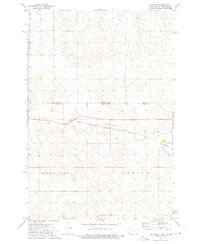
The settlement of Morristown sits at the intersection of critical rail infrastructure in this mid-1970s survey of the Standing Rock Indian Reservation. The village landscape is defined by the proximity of the Milwaukee St Paul and Pacific and Chicago rail lines, which provided the primary industrial and transport pulse for this region of Corson County. Water management and local resources are evident through the presence of Morristown Lake and Morristown East Lake, alongside a Sewage Disposal Pond and multiple instances of a Gravel Pit.
Find a feature on this map
13 named features on this map. Tap any name to fly to it.
Don’t see what you’re looking for? This feature index may not catch every label — zoom into the map to look around manually.
Map Details
Editions of this 1972 Morristown Map
This is the sole edition of this map. No revisions or reprints were ever made.
Other maps of this area

1953 · McIntosh
USGS Topo · 1:250,000

1954 · Bismarck
USGS Topo · 1:250,000

1958 · Bismarck
USGS Topo · 1:250,000

1958 · McIntosh
USGS Topo · 1:250,000

1972 · Pretty Rock Butte SE
USGS Topo · 1:24,000

1972 · Morristown SE
USGS Topo · 1:24,000

1972 · Skull Butte
USGS Topo · 1:24,000

1972 · Thunder Hawk SE
USGS Topo · 1:24,000
1972 · Keldron
USGS Topo · 1:24,000

1972 · Watauga
USGS Topo · 1:24,000
Featured Places
- Morristown, Rock Creek District
- Porcupine District, ND
- Rock Creek District, SD
- Sioux County, ND
- Corson County, SD