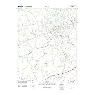
2010 Map of Morristown
USGS Topo · Published 2010About this map
Morristown serves as a regional hub in East Tennessee, anchored by its extensive municipal infrastructure and transport networks at the start of the 21st century. The landscape is characterized by a dense grid of cemeteries, such as the Emma Jarnagin Cemetery and Morelock Cemetery, which provide significant points of interest for genealogical research. The northern boundary is defined by the waters of Cherokee Lake, while the southern reaches descend toward Valley Home and the rural crossings along Sinking Creek. Industrial and aviation history are evident at Bell Quarry and the Morristown Municipal Airport. Drainage patterns are complex, with various branches like Turkey Creek and Williams Branch feeding local water bodies including Masengill Lake and Barrett Pond. This survey details the intersection of established neighborhoods like Hillcrest and Brentwood with the ridge-and-valley terrain of Crockett Ridge and Aunt Jane Hollow.
Find a feature on this map
111 named features on this map. Tap any name to fly to it.
Don’t see what you’re looking for? This feature index may not catch every label — zoom into the map to look around manually.
Map Details
Editions of this 2010 Morristown Map
This is the sole edition of this map. No revisions or reprints were ever made.
Other maps of this area

1883 · Morristown
USGS Topo · 1:125,000

1893 · Morristown
USGS Topo · 1:125,000

1895 · Morristown
USGS Topo · 1:125,000

1935 · White Pine
USGS Topo · 1:24,000

1935 · Rogersville
USGS Topo · 1:48,000

1935 · Tate Springs
USGS Topo · 1:48,000

1935 · Springvale
USGS Topo · 1:24,000

1935 · Avondale
USGS Topo · 1:24,000

1935 · Morristown
USGS Topo · 1:24,000

1935 · Russellville
USGS Topo · 1:24,000