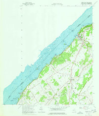
1963 Map of Morristown
USGS Topo · Published 1977About this map
The St Lawrence River defines this riverfront landscape, serving as the international boundary between the United States and Canada during the early 1960s. Along its banks, the village of Morristown stands as a focal point, supported by local infrastructure like the Central Sch and a prominent Water Tank. To the southwest, Jacques Cartier State Park occupies a significant stretch of the shoreline near Point Comfort, while inland, the community of Brier Hill and the adjacent Brier Hill Station suggest a landscape shaped by the Railroad and an Old Railroad Grade.
Find a feature on this map
50 named features on this map. Tap any name to fly to it.
Don’t see what you’re looking for? This feature index may not catch every label — zoom into the map to look around manually.
Map Details
Editions of this 1963 Morristown Map
3 editions found
Other maps of this area

1903 · Alexandria Bay
USGS Topo · 1:62,500

1906 · Brier Hill
USGS Topo · 1:62,500

1912 · Hammond
USGS Topo · 1:62,500

1942 · Morristown
USGS Topo · 1:24,000

1943 · Morristown
USGS Topo · 1:31,680

1943 · Edwardsville
USGS Topo · 1:31,680
1943 · Ogdensburg West
USGS Topo · 1:31,680

1944 · Hammond
USGS Topo · 1:62,500

1948 · Chippewa Bay
USGS Topo · 1:24,000

1948 · Alexandria Bay
USGS Topo · 1:62,500