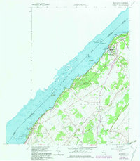
1963 Map of Morristown
USGS Topo · Published 1982About this map
The St Lawrence River forms a wide, island-studded border between the United States and Canada, defining the northern edge of this riverfront landscape. The village of Morristown serves as a focal point, where the Penn Central railroad meets the shoreline near Morristown Bay and the historic St Johns Sch. Inland, the terrain is shaped by a grid of rural routes with local names like English Settlement Road, Yankee Street, and Potato Street, reflecting the area's agricultural roots.
Find a feature on this map
60 named features on this map. Tap any name to fly to it.
Don’t see what you’re looking for? This feature index may not catch every label — zoom into the map to look around manually.
Map Details
Editions of this 1963 Morristown Map
3 editions found
Other maps of this area

1903 · Alexandria Bay
USGS Topo · 1:62,500

1906 · Brier Hill
USGS Topo · 1:62,500

1912 · Hammond
USGS Topo · 1:62,500

1942 · Morristown
USGS Topo · 1:24,000

1943 · Morristown
USGS Topo · 1:31,680

1943 · Edwardsville
USGS Topo · 1:31,680
1943 · Ogdensburg West
USGS Topo · 1:31,680

1944 · Hammond
USGS Topo · 1:62,500

1948 · Chippewa Bay
USGS Topo · 1:24,000

1948 · Alexandria Bay
USGS Topo · 1:62,500