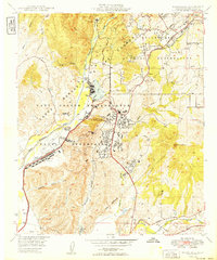
1949 Map of Morro Hill
USGS Topo · Published 1949About this map
The Camp Joseph H Pendleton Naval Reservation dominates this 1940s landscape, revealing the massive military infrastructure established in northern San Diego County. The map details a sophisticated network of specialized zones, from the sprawling Supply Depot and Naval Hospital to residential and administrative clusters like Camp de Luz. These installations are situated amidst a complex terrain of deep canyons including Aliso Canyon and Pueblitos Canyon, where the Santa Margarita River winds toward the coast.
Find a feature on this map
28 named features on this map. Tap any name to fly to it.
Don’t see what you’re looking for? This feature index may not catch every label — zoom into the map to look around manually.
Map Details
Editions of this 1949 Morro Hill Map
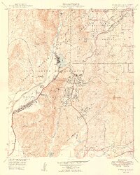
2 editions found
Other maps of this area

1893 · Oceanside
USGS Topo · 1:62,500

1893 · Escondido
USGS Topo · 1:62,500

1898 · Oceanside
USGS Topo · 1:62,500

1901 · Escondido
USGS Topo · 1:62,500

1901 · Oceanside
USGS Topo · 1:62,500

1901 · San Luis Rey
USGS Topo · 1:125,000

1904 · Southern California Sheet No. 2
USGS Topo · 1:250,000

1941 · Margarita Peak
USGS Topo · 1:62,500

1942 · Margarita Peak
USGS Topo · 1:62,500

1942 · Temecula
USGS Topo · 1:62,500
Featured Places
- Oceanside, CA
- Marine Corps Base Camp Pendleton, CA
- Jofegan, Marine Corps Base Camp Pendleton
- San Diego County, CA
- United States