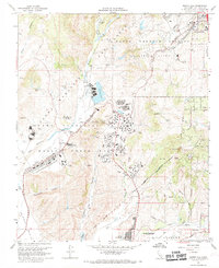
1968 Map of Morro Hill
USGS Topo · Published 1969About this map
The Camp Pendleton Marine Corps Base dominates this landscape, showing a complex network of military infrastructure including a rifle range, several firing ranges, and a dedicated training town. This 1968 revision provides a detailed look at the interface between the military installation and the growing community of Fallbrook to the northeast. Historical features of interest include the Ranch House and Home Ranch near the Santa Margarita River, along with a landing strip and the Windmill Golf Course located in the southern portion of the base. The presence of specialized facilities like an outdoor theater and the Hospital suggests a fully integrated military community during the Vietnam era. To the south, the corporate boundary of the Oceanside Reservation marks the transition toward the coast, while the Atchison Topeka and Santa Fe railroad line traces the canyon floor, serving as a primary transit corridor for the region.
Find a feature on this map
45 named features on this map. Tap any name to fly to it.
Don’t see what you’re looking for? This feature index may not catch every label — zoom into the map to look around manually.
Map Details
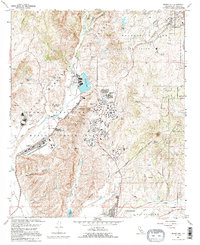
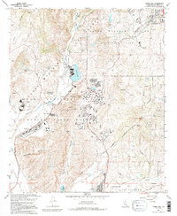
Editions of this 1968 Morro Hill Map
Other maps of this area

1893 · Oceanside
USGS Topo · 1:62,500

1893 · Escondido
USGS Topo · 1:62,500

1898 · Oceanside
USGS Topo · 1:62,500

1901 · Escondido
USGS Topo · 1:62,500

1901 · Oceanside
USGS Topo · 1:62,500

1901 · San Luis Rey
USGS Topo · 1:125,000

1904 · Southern California Sheet No. 2
USGS Topo · 1:250,000

1941 · Margarita Peak
USGS Topo · 1:62,500

1942 · Margarita Peak
USGS Topo · 1:62,500

1942 · Temecula
USGS Topo · 1:62,500
Featured Places
- Oceanside, CA
- Marine Corps Base Camp Pendleton, CA
- Jofegan, Marine Corps Base Camp Pendleton
- San Diego County, CA
- United States