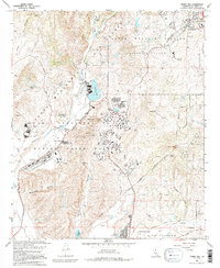
1968 Map of Morro Hill
USGS Topo · Published 1995About this map
Camp Pendleton Marine Corps Base dominates this coastal San Diego County landscape, showing the specialized infrastructure of a mid-century military installation. The map illustrates a high density of training and support facilities, including numerous firing ranges, an outdoor theater, and a dedicated Hospital near O'Neill Lake. To the north, the Las Flores Naval Weapons Station (Fallbrook Annex) occupies the terrain near the growing settlement of Fallbrook.
Find a feature on this map
43 named features on this map. Tap any name to fly to it.
Don’t see what you’re looking for? This feature index may not catch every label — zoom into the map to look around manually.
Map Details
Editions of this 1968 Morro Hill Map
Other maps of this area

1893 · Oceanside
USGS Topo · 1:62,500

1893 · Escondido
USGS Topo · 1:62,500

1898 · Oceanside
USGS Topo · 1:62,500

1901 · Escondido
USGS Topo · 1:62,500

1901 · Oceanside
USGS Topo · 1:62,500

1901 · San Luis Rey
USGS Topo · 1:125,000

1904 · Southern California Sheet No. 2
USGS Topo · 1:250,000

1941 · Margarita Peak
USGS Topo · 1:62,500

1942 · Margarita Peak
USGS Topo · 1:62,500

1942 · Temecula
USGS Topo · 1:62,500
Featured Places
- Oceanside, CA
- Marine Corps Base Camp Pendleton, CA
- Jofegan, Marine Corps Base Camp Pendleton
- San Diego County, CA
- United States