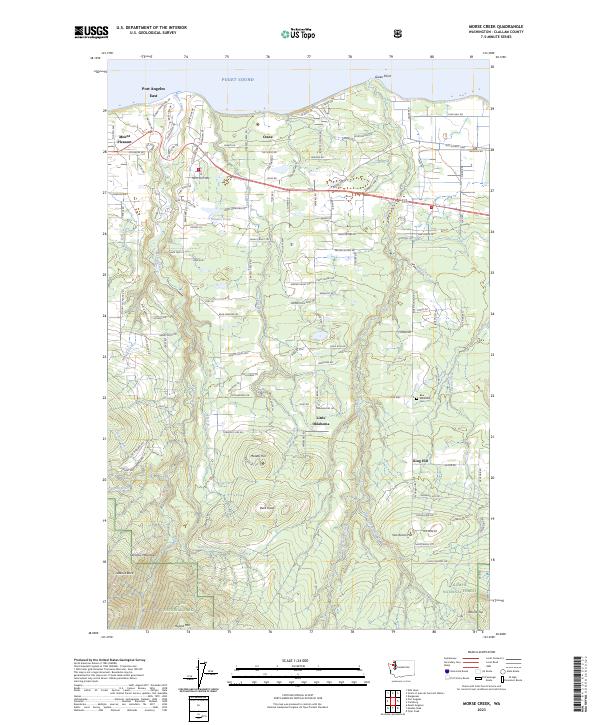
2023 Map of Morse Creek
USGS Topo · Published 2023About this map
Port Angeles East and the settlement of Crane anchor the northern coastline of the Olympic Peninsula on this contemporary survey of Clallam County. The landscape transitions rapidly from the saltwater of Puget Sound at Green Point to the high elevations of the Olympic Mountains. A dense network of residential and logging roads, such as Old Olympic Hwy and Blue Mountain Rd, weaves through the drainage basins of Morse Creek and Siebert Creek.
Find a feature on this map
140 named features on this map. Tap any name to fly to it.
Don’t see what you’re looking for? This feature index may not catch every label — zoom into the map to look around manually.
Map Details
Editions of this 2023 Morse Creek Map
This is the sole edition of this map. No revisions or reprints were ever made.
Other maps of this area

1918 · Port Angeles
USGS Topo · 1:62,500

1938 · Mt Constance
USGS Topo · 1:125,000

1938 · Dungeness
USGS Topo · 1:62,500

1939 · Dungeness
USGS Topo · 1:62,500

1941 · Port Angeles
USGS Topo · 1:62,500

1944 · Mt. Angeles
USGS Topo · 1:62,500

1946 · Mt. Angeles
USGS Topo · 1:62,500

1946 · Tyler Peak
USGS Topo · 1:62,500

1948 · Tyler Peak
USGS Topo · 1:62,500

1950 · Ediz Hook
USGS Topo · 1:24,000