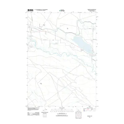
2012 Map of Morton
USGS Topo · Published 2012About this map
Wind River water management and desert agriculture define this portion of Fremont County, where a network of irrigation works including the Wyoming Canal, Hurtado Ditch, and Aragon Ditch supports the landscape. The settlement of Morton sits just west of the Pilot Butte Reservoir, a central feature for local water storage. The area's resource-based economy is further evidenced by the Pilot Butte Oil Field located in the western reaches of the survey. Family history and local heritage are preserved at the Hurtado Cem and Chavez Cem, which are situated near the bluffs. The terrain transitions from the flats of Mexican Flat to prominent landmarks such as Pilot Butte and Bighorn Butte, providing a detailed look at the geographic character of the Wind River Basin during the early 21st century.
Find a feature on this map
24 named features on this map. Tap any name to fly to it.
Don’t see what you’re looking for? This feature index may not catch every label — zoom into the map to look around manually.
Map Details
Editions of this 2012 Morton Map
This is the sole edition of this map. No revisions or reprints were ever made.
Other maps of this area

1950 · Pavillion
USGS Topo · 1:24,000

1950 · Pavillion Butte
USGS Topo · 1:24,000

1951 · Lookout Butte SW
USGS Topo · 1:24,000

1951 · Mule Butte
USGS Topo · 1:24,000

1951 · Morton
USGS Topo · 1:24,000

1951 · Fort Washakie
USGS Topo · 1:24,000

1951 · Lookout Butte
USGS Topo · 1:24,000

1951 · Argo Butte
USGS Topo · 1:24,000

1951 · Ethete
USGS Topo · 1:24,000

1955 · Thermopolis
USGS Topo · 1:250,000