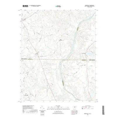
2019 Map of Morven East
USGS Topo · Published 2019About this map
The Pee Dee River carves a significant corridor through this region, serving as the boundary between North Carolina and South Carolina, as well as several counties. The settlement pattern here reflects the agricultural and milling history of the Carolinas, with rural hubs like Morven, McFarlan, and Everetts Mill dotting the landscape. One of the most intriguing points of interest is Old Sneedsboro, a location tied to the early 19th-century history of Anson County.
Find a feature on this map
66 named features on this map. Tap any name to fly to it.
Don’t see what you’re looking for? This feature index may not catch every label — zoom into the map to look around manually.
Map Details
Editions of this 2019 Morven East Map
This is the sole edition of this map. No revisions or reprints were ever made.
Other maps of this area

1941 · Spartanburg
USGS Topo · 1:250,000

1942 · Rockingham
USGS Topo · 1:125,000

1953 · Florence
USGS Topo · 1:250,000

1953 · Spartanburg
USGS Topo · 1:250,000

1954 · Florence
USGS Topo · 1:250,000
1956 · Rockingham
USGS Topo · 1:24,000
1956 · Lilesville
USGS Topo · 1:24,000

1956 · Wadesboro
USGS Topo · 1:24,000

1960 · Spartanburg
USGS Topo · 1:250,000

1963 · Spartanburg
USGS Topo · 1:250,000