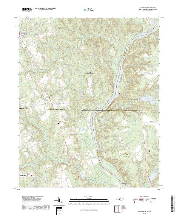
2022 Map of Morven East
USGS Topo · Published 2022About this map
The Pee Dee River carves a deep valley through this borderland where North and South Carolina meet, serving as a defining geographical and political boundary. The landscape is dotted with historical mill sites and river features, including the rocky outcrops at Stag Rock and the river-islands of Horse Island and Cane Island near Gordons Falls. Cultural markers of the 19th and 20th centuries are evident in the settlements of Morven and McFarlan, along with the remains of Old Sneedsboro, a once-vital river trading center. Genealogists will find significant value in documented burial grounds such as Mount Zion Methodist Church Cem, Pleasant Hill Cem, and Brocks Mill Cem. The drainage patterns of Whaleberry Cr and Westfield Cr illustrate the complex hydrography feeding the main river channel, while artificial impoundments like Nelson Lake and Everetts Lake show more modern transformations of the local watershed.
Find a feature on this map
71 named features on this map. Tap any name to fly to it.
Don’t see what you’re looking for? This feature index may not catch every label — zoom into the map to look around manually.
Map Details
Editions of this 2022 Morven East Map
This is the sole edition of this map. No revisions or reprints were ever made.
Other maps of this area

1941 · Spartanburg
USGS Topo · 1:250,000

1942 · Rockingham
USGS Topo · 1:125,000

1953 · Florence
USGS Topo · 1:250,000

1953 · Spartanburg
USGS Topo · 1:250,000

1954 · Florence
USGS Topo · 1:250,000
1956 · Rockingham
USGS Topo · 1:24,000
1956 · Lilesville
USGS Topo · 1:24,000

1956 · Wadesboro
USGS Topo · 1:24,000

1960 · Spartanburg
USGS Topo · 1:250,000

1963 · Spartanburg
USGS Topo · 1:250,000