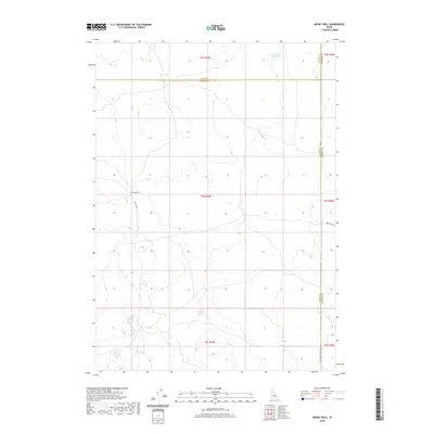
2020 Map of Mosby Well
USGS Topo · Published 2020About this map
Mosby Well anchors this high-desert landscape where three Idaho counties—Blaine, Power, and Bingham—converge. The terrain is defined by its water management and road network, with isolated water sources like Rock Lake and Sand Lake Reservoir serving the arid surroundings. This 2020 survey illustrates a sparsely populated region primarily organized by the Public Land Survey System, with township and range lines such as t4s r29e providing the primary structure for the few arterial roads. Notable thoroughfares like Flat Top Rd and the straight-edged Co Line Rd 1600 West Rd reflect the utilitarian nature of the local infrastructure, likely supporting grazing or agricultural interests near the county boundaries.
Find a feature on this map
15 named features on this map. Tap any name to fly to it.
Don’t see what you’re looking for? This feature index may not catch every label — zoom into the map to look around manually.
Map Details
Editions of this 2020 Mosby Well Map
This is the sole edition of this map. No revisions or reprints were ever made.
Other maps of this area

1934 · American Falls
USGS Topo · 1:62,500

1936 · American Falls
USGS Topo · 1:62,500

1954 · Pocatello
USGS Topo · 1:250,000

1955 · Idaho Falls
USGS Topo · 1:250,000

1958 · Idaho Falls
USGS Topo · 1:250,000

1958 · Pocatello
USGS Topo · 1:250,000

1971 · American Falls NW
USGS Topo · 1:24,000

1972 · Antelope Lake
USGS Topo · 1:24,000

1972 · Split Top
USGS Topo · 1:24,000

1972 · Mosby Well
USGS Topo · 1:24,000