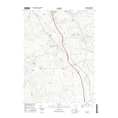
2016 Map of Moscow
USGS Topo · Published 2016About this map
The Moosic Mountains dominate the western portion of this Lackawanna County landscape, where the terrain drops sharply toward the water-rich valleys of the east. This 2016 survey captures the established borough of Moscow and its surrounding rural hamlets, including Tooley Corners, Quinlan Corners, and Fells Corners. The area is defined by a complex network of waterways and drainage, featuring the Elmhurst Reservoir and Watres Reservoir, alongside smaller bodies like Maple Lake and Hazard Pond. The presence of the Lazy J Ranch Airport and the Fairview Memorial Estate near Elmhurst illustrates the mix of recreational aviation and civic infrastructure in this pocket of Pennsylvania. Genealogists may find interest in the location of Saint Catherines Cem near the center of the borough, while the various swamp lands such as Mullen Swamp and Langan Swamp indicate the low-lying, marshy character of the high-elevation basins between the ridges.
Find a feature on this map
89 named features on this map. Tap any name to fly to it.
Don’t see what you’re looking for? This feature index may not catch every label — zoom into the map to look around manually.
Map Details
Editions of this 2016 Moscow Map
This is the sole edition of this map. No revisions or reprints were ever made.
Other maps of this area

1889 · Scranton
USGS Topo · 1:62,500

1891 · Scranton
USGS Topo · 1:62,500

1893 · Scranton
USGS Topo · 1:62,500

1919 · Pocono
USGS Topo · 1:62,500

1921 · Pocono
USGS Topo · 1:62,500

1922 · Stoddartsville
USGS Topo · 1:62,500

1923 · Pocono
USGS Topo · 1:62,500

1924 · Stoddartsville
USGS Topo · 1:62,500

1928 · Ariel
USGS Topo · 1:62,500

1932 · Ariel
USGS Topo · 1:62,500