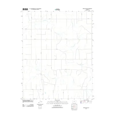
2012 Map of Moscow NW
USGS Topo · Published 2012About this map
The Cimarron River and its northern tributary, the N Fork Cimarron River, carve a winding path through the high plains of Grant County. This 2012 survey documents a landscape defined by its rigid section-line road network, where routes like S Rd Q and S Rd R intersect the expansive horizontal stretches of E Road 20 and E Road 22. The terrain is characterized by the wide, sandy beds of these intermittent western rivers, which dictate the placement of crossings and the few irregular property boundaries in an otherwise geometric grid. Local thoroughfares such as 4mi Rd and 6mi Rd provide the primary infrastructure for the region's agricultural activity, connecting the rural homesteads and fields that occupy the spaces between the watercourses.
Find a feature on this map
20 named features on this map. Tap any name to fly to it.
Don’t see what you’re looking for? This feature index may not catch every label — zoom into the map to look around manually.
Map Details
Editions of this 2012 Moscow NW Map
This is the sole edition of this map. No revisions or reprints were ever made.
Other maps of this area

1891 · Larned
USGS Topo · 1:125,000

1900 · Lakin
USGS Topo · 1:125,000

1944 · Moscow
USGS Topo · 1:62,500

1945 · Moscow
USGS Topo · 1:62,500

1955 · Dodge City
USGS Topo · 1:250,000

1958 · Dodge City
USGS Topo · 1:250,000

1959 · Dodge City
USGS Topo · 1:250,000

1959 · Ulysses
USGS Topo · 1:24,000

1959 · Hickok
USGS Topo · 1:24,000

1960 · Hickok SE
USGS Topo · 1:24,000