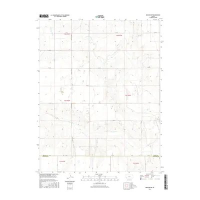
2016 Map of Moscow NW
USGS Topo · Published 2016About this map
The Cimarron River and its northern tributary, the N Fork Cimarron River, dominate this landscape at the intersection of Grant and Stevens Counties. This high-plains environment is defined by a rigorous section-line road network, including Co Rd 18, Co Rd 22, and the boundary-defining Co Rd DD. The map illustrates the characteristic agricultural surveying of western Kansas, where deep drainage cuts from the river systems break the otherwise uniform grid of the Public Land Survey System. The topography reveals the subtle elevation changes along the river breaks, contrasting the flat agricultural uplands with the more complex terrain immediately surrounding the watercourses. This layout provides a clear view of land management and transportation patterns on the edge of the Grant Co line in the mid-2010s.
Find a feature on this map
18 named features on this map. Tap any name to fly to it.
Don’t see what you’re looking for? This feature index may not catch every label — zoom into the map to look around manually.
Map Details
Editions of this 2016 Moscow NW Map
This is the sole edition of this map. No revisions or reprints were ever made.
Other maps of this area

1891 · Larned
USGS Topo · 1:125,000

1900 · Lakin
USGS Topo · 1:125,000

1944 · Moscow
USGS Topo · 1:62,500

1945 · Moscow
USGS Topo · 1:62,500

1955 · Dodge City
USGS Topo · 1:250,000

1958 · Dodge City
USGS Topo · 1:250,000

1959 · Dodge City
USGS Topo · 1:250,000

1959 · Ulysses
USGS Topo · 1:24,000

1959 · Hickok
USGS Topo · 1:24,000

1960 · Hickok SE
USGS Topo · 1:24,000