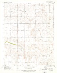
1975 Map of Moscow NW
USGS Topo · Published 1976About this map
The Santa Fe (Approximate Location) Trail cuts across the northern landscape of this Kansas high plains region, marking the path of an era-defining migration route. This 1970s survey captures a transition toward an energy-driven economy, evidenced by the numerous Gas Wells and pipelines scattered throughout the townships of Lincoln and Sullivan. The settlement of Carter stands as a focal point in an otherwise open terrain defined by the winding course of the North Fork Cimarron River and the main Cimarron River to the south.
Find a feature on this map
11 named features on this map. Tap any name to fly to it.
Don’t see what you’re looking for? This feature index may not catch every label — zoom into the map to look around manually.
Map Details
Editions of this 1975 Moscow NW Map
This is the sole edition of this map. No revisions or reprints were ever made.
Other maps of this area

1891 · Larned
USGS Topo · 1:125,000

1900 · Lakin
USGS Topo · 1:125,000

1944 · Moscow
USGS Topo · 1:62,500

1945 · Moscow
USGS Topo · 1:62,500

1955 · Dodge City
USGS Topo · 1:250,000

1958 · Dodge City
USGS Topo · 1:250,000

1959 · Dodge City
USGS Topo · 1:250,000

1959 · Ulysses
USGS Topo · 1:24,000

1959 · Hickok
USGS Topo · 1:24,000

1960 · Hickok SE
USGS Topo · 1:24,000