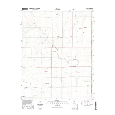
2013 Map of Moses
USGS Topo · Published 2013About this map
Old Moses and the nearby settlement of Moses anchor this high-plains landscape in Union County, where the dry arroyo systems of the Oklahoma-New Mexico borderland define the local geography. The area's ranching heritage is evidenced by scattered landmarks like the Wood Windmill and Monument Windmill, along with the winding course of Corrumpa Creek. To the south, the expansive Kiowa National Grassland encompasses a significant portion of the terrain, preserving the open character of the Shortgrass Prairie. Genealogists can locate several small burial grounds tied to early settlement families, including Puertocito Cem, Moses Cem, and Rinker Cem. Further north, Elephant Rock stands as a notable natural landmark above Corrumpa Cr, while McNees Crossing identifies a specific point of passage across the drainage network that feeds into the Cimarron River basin.
Find a feature on this map
33 named features on this map. Tap any name to fly to it.
Don’t see what you’re looking for? This feature index may not catch every label — zoom into the map to look around manually.
Map Details
Editions of this 2013 Moses Map
This is the sole edition of this map. No revisions or reprints were ever made.
Other maps of this area

1954 · Dalhart
USGS Topo · 1:250,000

1958 · Dalhart
USGS Topo · 1:250,000

1962 · Dalhart
USGS Topo · 1:250,000

1969 · Felt SW
USGS Topo · 1:24,000

1969 · Wheeless
USGS Topo · 1:24,000
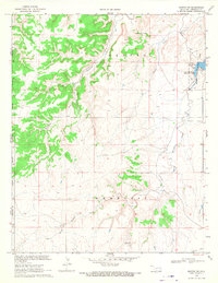
1969 · Kenton SW
USGS Topo · 1:24,000

1972 · Seneca
USGS Topo · 1:24,000

1972 · Atencio
USGS Topo · 1:24,000

1972 · Rardin Hill
USGS Topo · 1:24,000

1972 · Moses
USGS Topo · 1:24,000