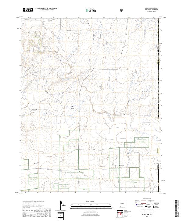
2023 Map of Moses
USGS Topo · Published 2023About this map
Moses sits at the heart of this high plains landscape in northeastern New Mexico, where the transition between current and former settlement is marked by the proximity of Old Moses. This corner of Union County is defined by the winding course of Corrumpa Creek and its various tributaries, including Plunket Draw and the seasonal waters of Gyp Arroyo. The map reveals a deeply rooted rural history, preserved in the distribution of family and community burial grounds such as Puertocito Cem, Moses Cem, Rinker Cem, and Baker Cem. Large portions of the terrain are dedicated to the Kiowa National Grassland, highlighting the regional importance of conservation and open range. The eastern edge of the survey tracks the boundary shared with Oklahoma, specifically Cimarron County, showing how the local road network, including Atencio Rd and Corrumpa Rd, navigates the draws and arroyos of this arid environment.
Find a feature on this map
25 named features on this map. Tap any name to fly to it.
Don’t see what you’re looking for? This feature index may not catch every label — zoom into the map to look around manually.
Map Details
Editions of this 2023 Moses Map
This is the sole edition of this map. No revisions or reprints were ever made.
Other maps of this area

1954 · Dalhart
USGS Topo · 1:250,000

1958 · Dalhart
USGS Topo · 1:250,000

1962 · Dalhart
USGS Topo · 1:250,000

1969 · Felt SW
USGS Topo · 1:24,000

1969 · Wheeless
USGS Topo · 1:24,000
1969 · Kenton SW
USGS Topo · 1:24,000

1972 · Seneca
USGS Topo · 1:24,000

1972 · Atencio
USGS Topo · 1:24,000

1972 · Rardin Hill
USGS Topo · 1:24,000

1972 · Moses
USGS Topo · 1:24,000