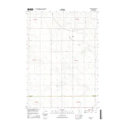
2015 Map of Mosher
USGS Topo · Published 2015About this map
The small settlement of Mosher sits at the convergence of local roads in the rolling plains of South Dakota. This 2015 survey illustrates a landscape primarily defined by its drainage network, where Oak Cr and its tributaries, such as White Horse Cr and De Bell Cr, have carved distinct paths through the terrain. The presence of the Advent Cem provides a focal point for genealogical interest, marking a historical site of communal significance within the township lines.
Find a feature on this map
30 named features on this map. Tap any name to fly to it.
Don’t see what you’re looking for? This feature index may not catch every label — zoom into the map to look around manually.
Map Details
Editions of this 2015 Mosher Map
This is the sole edition of this map. No revisions or reprints were ever made.
Other maps of this area

1955 · Martin
USGS Topo · 1:250,000

1958 · Martin
USGS Topo · 1:250,000

1982 · Two Nation Creek
USGS Topo · 1:25,000

1982 · Wood North
USGS Topo · 1:24,000

1982 · Badnation SE
USGS Topo · 1:25,000

1982 · Okreek
USGS Topo · 1:25,000

1982 · Witten SW
USGS Topo · 1:25,000

1982 · Okreek SE
USGS Topo · 1:24,000
1982 · Carter
USGS Topo · 1:25,000

1982 · Mosher
USGS Topo · 1:25,000