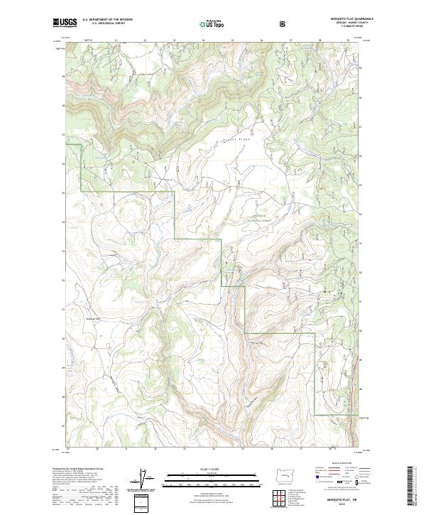
2023 Map of Mosquito Flat
USGS Topo · Published 2023About this map
Malheur National Forest dominates this high-elevation landscape in Harney County, where the Silvies River and its tributaries carve through the volcanic geology of the High Desert. The terrain is defined by prominent topographical markers like Gravel Ridge and Mahogany Ridge, which frame the low-lying Mosquito Flat. This area is an essential water source for local livestock and wildlife, evidenced by a dense network of named water sources including Bob Bennett Spring, Peabody Spring, and Landing Creek Spring. The southeastern corner of the quadrangle reveals the deep incisions of Devine Canyon and Varien Canyon, where the drainage patterns shift significantly. Aside from the forest service road Theimer S, the region remains largely primitive, characterized by its complex network of gulches and creeks such as Dry Creek and Stancliffe Creek that feed the river system.
Find a feature on this map
30 named features on this map. Tap any name to fly to it.
Don’t see what you’re looking for? This feature index may not catch every label — zoom into the map to look around manually.
Map Details
Editions of this 2023 Mosquito Flat Map
This is the sole edition of this map. No revisions or reprints were ever made.
Other maps of this area

1955 · Burns
USGS Topo · 1:250,000

1958 · Burns
USGS Topo · 1:250,000

1959 · Burns
USGS Topo · 1:250,000

1959 · West Myrtle Butte
USGS Topo · 1:62,500

1959 · Harney
USGS Topo · 1:62,500

1960 · Burns
USGS Topo · 1:62,500

1961 · Calamity Butte
USGS Topo · 1:62,500

1978 · Stinkingwater Mountains
USGS Topo · 1:100,000
1990 · Poison Creek
USGS Topo · 1:24,000
1990 · Burns NW
USGS Topo · 1:24,000