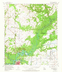
1957 Map of Moss Bluff
USGS Topo · Published 1965About this map
Calcasieu River dominates this landscape as it meanders through the wetlands north of Lake Charles, creating a complex system of bayous, cutoffs, and bends. In the late 1950s, the area shows a distinct transition from the river-bottom swamps of Sam Houston State Park to the emerging upland settlements of Moss Bluff and Topsy. The map records an economy driven by the Iowa Oil and Gas Field, with numerous oil and gas wells, sludge pits, and pumping stations dotting the eastern plains. Local life is anchored by family-named landmarks and institutions like Moss Bluff School and several small burial grounds, including Ritchie Cemetery and Birdsnest Cemetery. Transportation is defined by the Southern Pacific railroad and early industrial corridors like Goldsmith Grade, which cut through the pine and marshland to support the region's resource extraction.
Find a feature on this map
99 named features on this map. Tap any name to fly to it.
Don’t see what you’re looking for? This feature index may not catch every label — zoom into the map to look around manually.
Map Details
Editions of this 1957 Moss Bluff Map
3 editions found
Other maps of this area

1932 · Lake Charles NE
USGS Topo · 1:31,680

1932 · Lake Charles NW
USGS Topo · 1:31,680

1935 · Buhler
USGS Topo · 1:31,680

1935 · Moss Bluff
USGS Topo · 1:31,680

1935 · Gordon
USGS Topo · 1:31,680

1935 · Gaytine
USGS Topo · 1:31,680

1935 · Longville
USGS Topo · 1:31,680

1942 · Lake Charles
USGS Topo · 1:62,500

1946 · Lacassine
USGS Topo · 1:31,680

1947 · Gaytine
USGS Topo · 1:31,680