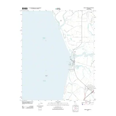
2012 Map of Moss Landing
USGS Topo · Published 2012About this map
Moss Landing and the inland town of Castroville anchor this coastal landscape where several significant waterways converge at the Pacific Ocean. The complex hydrology of the Monterey Bay shoreline is documented in detail, featuring the Elkhorn Slough, Bennett Slough, and the meandering course of the Old Salinas River. The map highlights the industrial and scientific infrastructure of the harbor area, including the Moss Landing Marine Laboratories, Sandholdt Pier, and Sandholdt Bridge.
Find a feature on this map
49 named features on this map. Tap any name to fly to it.
Don’t see what you’re looking for? This feature index may not catch every label — zoom into the map to look around manually.
Map Details
Editions of this 2012 Moss Landing Map
This is the sole edition of this map. No revisions or reprints were ever made.
Other maps of this area

1910 · Salinas
USGS Topo · 1:31,680

1912 · Salinas
USGS Topo · 1:62,500

1912 · Capitola
USGS Topo · 1:62,500

1913 · Monterey
USGS Topo · 1:62,500

1914 · Capitola
USGS Topo · 1:62,500

1915 · San Juan Bautista
USGS Topo · 1:48,000

1917 · San Juan Bautista
USGS Topo · 1:62,500

1939 · San Juan Bautista
USGS Topo · 1:62,500

1940 · San Juan Bautista
USGS Topo · 1:62,500

1940 · Salinas
USGS Topo · 1:62,500