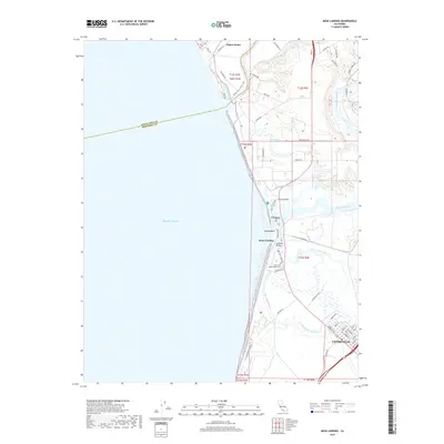
2018 Map of Moss Landing
USGS Topo · Published 2018About this map
Elkhorn Slough and the winding Moro Cojo Slough dominate this coastal landscape, where the tides meet a network of wetlands and agricultural tracts. The port at Moss Landing serves as a central hub, linked by the Sandholdt Bridge and surrounded by landmarks like Pauls Island and Island Beach. The map details the transition from the sandy reaches of Pajaro Dunes in the north down to the residential streets of Castroville in the south.
Find a feature on this map
58 named features on this map. Tap any name to fly to it.
Don’t see what you’re looking for? This feature index may not catch every label — zoom into the map to look around manually.
Map Details
Editions of this 2018 Moss Landing Map
This is the sole edition of this map. No revisions or reprints were ever made.
Other maps of this area

1910 · Salinas
USGS Topo · 1:31,680

1912 · Salinas
USGS Topo · 1:62,500

1912 · Capitola
USGS Topo · 1:62,500

1913 · Monterey
USGS Topo · 1:62,500

1914 · Capitola
USGS Topo · 1:62,500

1915 · San Juan Bautista
USGS Topo · 1:48,000

1917 · San Juan Bautista
USGS Topo · 1:62,500

1939 · San Juan Bautista
USGS Topo · 1:62,500

1940 · San Juan Bautista
USGS Topo · 1:62,500

1940 · Salinas
USGS Topo · 1:62,500