Loading...
Loading map...2021 Map of Moss Landing
USGS Topo · Published 2021About this map
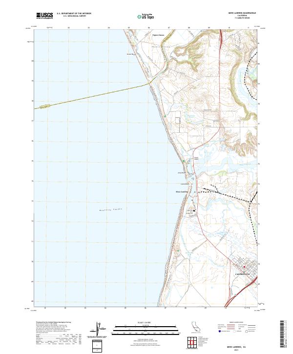
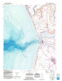
Pajaro Valley meets the Monterey Bay shoreline in this detailed coastal survey, where the complex hydrology of the Central Coast is on full display. The Pajaro River forms the northern boundary of the terrestrial map, giving way to the intricate wetlands of Elkhorn Slough and McClusky Slough. At the heart of the coast, Moss Landing sits at the mouth of the Old Salinas River, a critical point where the massive underwater Monterey Canyon begins its descent just offshore.
Find a feature on this map
64 named features on this map. Tap any name to fly to it.
Don’t see what you’re looking for? This feature index may not catch every label — zoom into the map to look around manually.
Map Details
Date Portrayed2021
Date Published2021
PublisherU.S. Geological Survey
Map TypeTopographic
Scale1:24000
Physical Dimensions24 x 29 inches
Editions of this 2021 Moss Landing Map
This is the sole edition of this map. No revisions or reprints were ever made.
Historical Maps of Pajaro Dunes Through Time
Featured Locations
Source Details
SourceU.S. Geological Survey
CopyrightPublic Domain