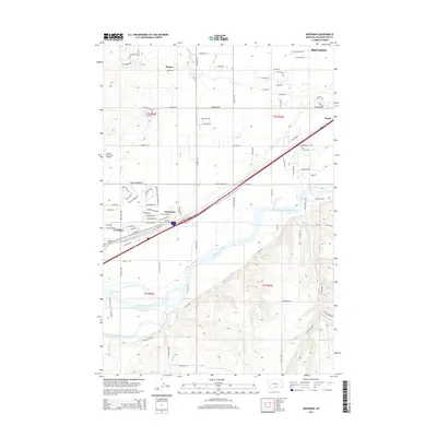
2014 Map of Mossmain
USGS Topo · Published 2014About this map
The confluence of the Yellowstone River and the Clarks Fork Yellowstone River dominates this 2014 survey of the western outskirts of Billings. This landscape is defined by the transition from the irrigated river valley floors to the higher benchlands. The industrial and transit importance of the region is evident at the rail and road junction of Mossmain, situated just east of the city of Laurel. Evidence of the area's agricultural engineering is visible through the Mason Canal and High Ditch, which redirect water across the terrain to support the surrounding plains.
Find a feature on this map
91 named features on this map. Tap any name to fly to it.
Don’t see what you’re looking for? This feature index may not catch every label — zoom into the map to look around manually.
Map Details
Editions of this 2014 Mossmain Map
This is the sole edition of this map. No revisions or reprints were ever made.
Other maps of this area

1954 · Billings
USGS Topo · 1:250,000

1956 · Rimrock
USGS Topo · 1:24,000

1956 · Silesia
USGS Topo · 1:24,000

1956 · Two Pine School
USGS Topo · 1:24,000

1956 · Laurel
USGS Topo · 1:24,000

1956 · Yegen
USGS Topo · 1:24,000

1956 · Mossmain
USGS Topo · 1:24,000

1957 · Billings
USGS Topo · 1:250,000

1957 · Billings West
USGS Topo · 1:24,000

1958 · Billings
USGS Topo · 1:250,000