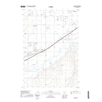
2020 Map of Mossmain
USGS Topo · Published 2020About this map
The confluence of the Clarks Fork Yellowstone River and the Yellowstone River anchors this landscape west of Billings. The area is defined by a dense network of water management and transport, where the Mason-Canal cuts through the river valley alongside the central rail corridor. The small settlement of Mossmain serves as a junction point between Laurel and the growing outskirts of the city. While much of the terrain is occupied by the braided channels of the river system, the northern sections show a transition into rural residential developments like Hesper and Yegen. This survey illustrates the intricate balance between industrial transport infrastructure and the irrigation-dependent agriculture of the Yellowstone valley, featuring local facilities like the Laurel Municipal Airport and Landing Pointe Airport.
Find a feature on this map
94 named features on this map. Tap any name to fly to it.
Don’t see what you’re looking for? This feature index may not catch every label — zoom into the map to look around manually.
Map Details
Editions of this 2020 Mossmain Map
This is the sole edition of this map. No revisions or reprints were ever made.
Other maps of this area

1954 · Billings
USGS Topo · 1:250,000

1956 · Rimrock
USGS Topo · 1:24,000

1956 · Silesia
USGS Topo · 1:24,000

1956 · Two Pine School
USGS Topo · 1:24,000

1956 · Laurel
USGS Topo · 1:24,000

1956 · Yegen
USGS Topo · 1:24,000

1956 · Mossmain
USGS Topo · 1:24,000

1957 · Billings
USGS Topo · 1:250,000

1957 · Billings West
USGS Topo · 1:24,000

1958 · Billings
USGS Topo · 1:250,000