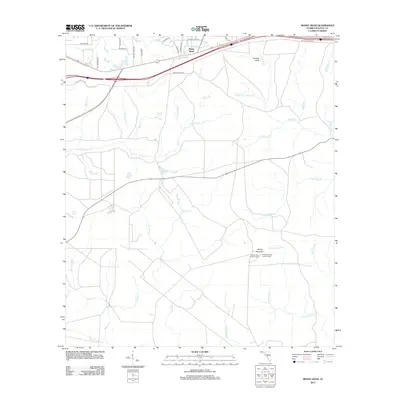
2012 Map of Mossy Head
USGS Topo · Published 2012About this map
Mossy Head sits at the center of this Panhandle landscape, where the headwaters of numerous creeks begin their descent toward the Gulf. The drainage pattern is the most striking element of the geography, with watercourses like Titi Cr, Alaqua Cr, and Rocky Cr branching out through the sandy terrain. While the modern transportation corridor of Interstate 10 and the railroad dominate the northern section, the map reveals a history of elevation-based monitoring with both the Mossy Head Lookout Tower and the Sandy Mountain Lookout Tower situated on high points. These towers served as critical watchpoints for the surrounding timberlands. Further south, the landscape transitions into a network of ponds and minor branches, including Bull Pond and Indigo Pond, illustrating the hydrology of Walton County.
Find a feature on this map
51 named features on this map. Tap any name to fly to it.
Don’t see what you’re looking for? This feature index may not catch every label — zoom into the map to look around manually.
Map Details
Editions of this 2012 Mossy Head Map
This is the sole edition of this map. No revisions or reprints were ever made.
Other maps of this area

1934 · Niceville
USGS Topo · 1:48,000

1935 · De Funiak Springs
USGS Topo · 1:48,000

1936 · Niceville
USGS Topo · 1:62,500

1938 · De Funiak Springs
USGS Topo · 1:62,500

1949 · Glendale
USGS Topo · 1:62,500

1949 · Laurel Hill
USGS Topo · 1:62,500

1950 · Laurel Hill
USGS Topo · 1:62,500

1951 · Glendale
USGS Topo · 1:62,500

1956 · Niceville
USGS Topo · 1:62,500

1957 · Pensacola
USGS Topo · 1:250,000