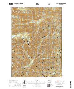
2020 Map of Mother Lode Mountain
USGS Topo · Published 2020About this map
Mother Lode Mtn and Pansy Mtn define the northern terrain of this section of the Oregon Cascades, situated at the boundary between the Mount Hood National Forest and the Willamette National Forest. The landscape is defined by a dense network of high-elevation watercourses and ridges, where the Breitenbush River flows through the southern reaches near Humbug Flats and Hoover Ridge. Historic land management and fire observation points are evident at Gold Butte Lookout, perched atop Gold Butte. This 2020 survey documents the complex hydrography of the region, from the headwaters of Mother Lode Cr and Elk Lake Creek to isolated alpine features like Twin Lakes and Leone Lake. The map provides a precise record of these forest lands, tracing the numerous drainages such as Dunlap Cr and Humbug Cr that carve through the volcanic topography.
Find a feature on this map
42 named features on this map. Tap any name to fly to it.
Don’t see what you’re looking for? This feature index may not catch every label — zoom into the map to look around manually.
Map Details
Editions of this 2020 Mother Lode Mountain Map
This is the sole edition of this map. No revisions or reprints were ever made.
Other maps of this area

1927 · Mt. Jefferson
USGS Topo · 1:125,000

1929 · Mill City
USGS Topo · 1:125,000

1930 · Mt. Jefferson
USGS Topo · 1:125,000

1953 · Salem
USGS Topo · 1:250,000

1954 · Salem
USGS Topo · 1:250,000

1955 · Bend
USGS Topo · 1:250,000

1956 · Battle Ax
USGS Topo · 1:62,500

1956 · Detroit
USGS Topo · 1:62,500

1957 · Bend
USGS Topo · 1:250,000

1958 · Bend
USGS Topo · 1:250,000