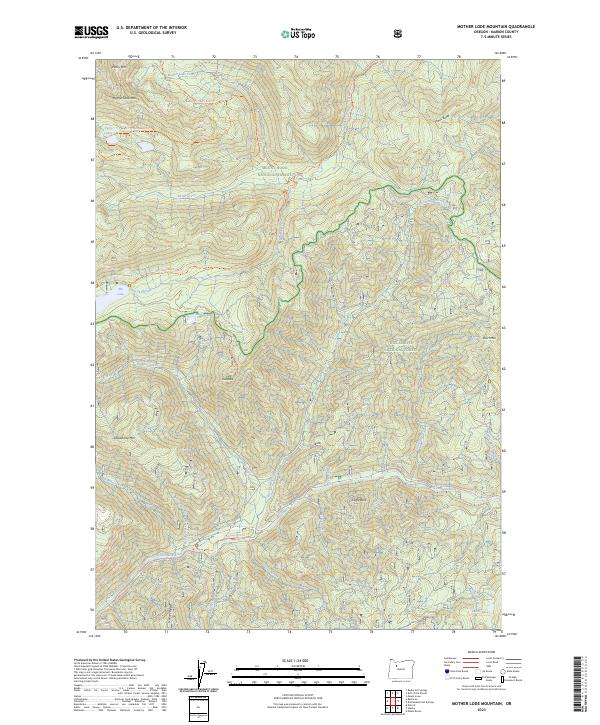
2023 Map of Mother Lode Mountain
USGS Topo · Published 2023About this map
The Breitenbush River flows through a heavily forested landscape on the border of Marion County in the 2020s. This region is a complex intersection of administrative boundaries, where the Mount Hood National Forest and Willamette National Forest meet the protected expanse of the Bull of the Woods Wilderness. Significant peaks including Mother Lode Mtn and Deadhorse Mtn define the topography, while a network of established paths like the Gold Butte Lookout Trl and Mother Lode Trl provide access to high-elevation points such as Janus Butte. The drainage pattern is dense, with many smaller streams like Humbug Creek and Scorpion Creek feeding into the larger river system, reflecting the area's role as a vital watershed. Isolated alpine waters, including Elk Lake and Dunlap Lake, are tucked into the high ridges, serving as landmarks for those studying the recreational and ecological layout of the Oregon Cascades.
Find a feature on this map
39 named features on this map. Tap any name to fly to it.
Don’t see what you’re looking for? This feature index may not catch every label — zoom into the map to look around manually.
Map Details
Editions of this 2023 Mother Lode Mountain Map
This is the sole edition of this map. No revisions or reprints were ever made.
Other maps of this area

1927 · Mt. Jefferson
USGS Topo · 1:125,000

1929 · Mill City
USGS Topo · 1:125,000

1930 · Mt. Jefferson
USGS Topo · 1:125,000

1953 · Salem
USGS Topo · 1:250,000

1954 · Salem
USGS Topo · 1:250,000

1955 · Bend
USGS Topo · 1:250,000

1956 · Battle Ax
USGS Topo · 1:62,500

1956 · Detroit
USGS Topo · 1:62,500

1957 · Bend
USGS Topo · 1:250,000

1958 · Bend
USGS Topo · 1:250,000