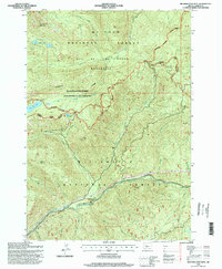
1994 Map of Mother Lode Mtn
USGS Topo · Published 1998About this map
Mother Lode Mountain and the surrounding high-altitude terrain of the Oregon Cascades define this landscape during the mid-1990s. This region is a complex overlap of protected lands, where the Mt Hood National Forest and Willamette National Forest meet. The map reveals a high concentration of alpine lakes, including Twin Lakes, Elk Lake, and Dunlap Lake, which serve as headwaters for major drainages like Elk Creek and the Breitenbush River.
Find a feature on this map
29 named features on this map. Tap any name to fly to it.
Don’t see what you’re looking for? This feature index may not catch every label — zoom into the map to look around manually.
Map Details
Editions of this 1994 Mother Lode Mtn Map
This is the sole edition of this map. No revisions or reprints were ever made.
Other maps of this area

1927 · Mt. Jefferson
USGS Topo · 1:125,000

1929 · Mill City
USGS Topo · 1:125,000

1930 · Mt. Jefferson
USGS Topo · 1:125,000

1953 · Salem
USGS Topo · 1:250,000

1954 · Salem
USGS Topo · 1:250,000

1955 · Bend
USGS Topo · 1:250,000

1956 · Battle Ax
USGS Topo · 1:62,500

1956 · Detroit
USGS Topo · 1:62,500

1957 · Bend
USGS Topo · 1:250,000

1958 · Bend
USGS Topo · 1:250,000