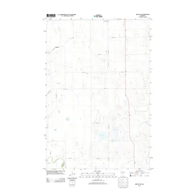
2013 Map of Motley NW
USGS Topo · Published 2013About this map
The settlement of Esterdy and the Swan Valley Cem anchor this landscape along the Wadena and Cass county line. The terrain is defined by an intricate network of wetlands and water bodies, including Cat Lake, Dog Lake, Johnson Lake, and Rice Lake. These basins feed local drainage systems like Iron Cr, Swan Cr, and Mosquito Cr, all contributing to the broader watershed of the Crow Wing River which meanders across the southwestern corner of the quadrangle.
Find a feature on this map
32 named features on this map. Tap any name to fly to it.
Don’t see what you’re looking for? This feature index may not catch every label — zoom into the map to look around manually.
Map Details
Editions of this 2013 Motley NW Map
This is the sole edition of this map. No revisions or reprints were ever made.
Other maps of this area

1919 · Leader
USGS Topo · 1:62,500

1953 · Brainerd
USGS Topo · 1:250,000

1957 · Brainerd
USGS Topo · 1:250,000

1958 · Brainerd
USGS Topo · 1:250,000
1963 · Motley SE
USGS Topo · 1:24,000

1963 · Motley
USGS Topo · 1:24,000

1965 · Brainerd
USGS Topo · 1:250,000

1966 · Staples NE
USGS Topo · 1:24,000
1966 · Casino
USGS Topo · 1:24,000
1966 · Motley NW
USGS Topo · 1:24,000