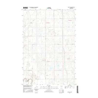
2016 Map of Motley NW
USGS Topo · Published 2016About this map
Esterdy and the surrounding wetland landscape of Cass Co and Wadena Co are documented in this 2016 survey. The terrain is defined by a dense network of glacial basins and water bodies, including Dog Lake, Cat Lake, and the sprawling Mud Lake. The map reveals a remote rural infrastructure centered around the Swan Valley Cem and a grid of township roads such as Swan Valley Cemetary Rd and 96th St SW. The hydrology of the area is complex, with Mosquito Cr and its eastern branch draining the eastern sections while Iron Cr and Swan Cr meander through the north. This modern topography captures the persistent character of the Minnesota lake country, showing how local access like Long Driveway and county routes navigate the intervening marshes and timbered lands.
Find a feature on this map
44 named features on this map. Tap any name to fly to it.
Don’t see what you’re looking for? This feature index may not catch every label — zoom into the map to look around manually.
Map Details
Editions of this 2016 Motley NW Map
This is the sole edition of this map. No revisions or reprints were ever made.
Other maps of this area

1919 · Leader
USGS Topo · 1:62,500

1953 · Brainerd
USGS Topo · 1:250,000

1957 · Brainerd
USGS Topo · 1:250,000

1958 · Brainerd
USGS Topo · 1:250,000
1963 · Motley SE
USGS Topo · 1:24,000

1963 · Motley
USGS Topo · 1:24,000

1965 · Brainerd
USGS Topo · 1:250,000

1966 · Staples NE
USGS Topo · 1:24,000
1966 · Casino
USGS Topo · 1:24,000
1966 · Motley NW
USGS Topo · 1:24,000