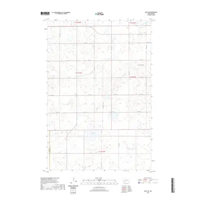
2020 Map of Mott SW
USGS Topo · Published 2020About this map
The Cannonball River cuts through the northeast corner of this landscape, a region defined by its sprawling drainage networks and high-plains topography. Located at the intersection of several townships, the area features prominent water bodies such as Van Patton Slough and the winding Chilton Cr. A distinct geological landmark, Forsch Rocks, rises above the rolling terrain in the eastern portion of the quadrangle. The map documents a sparse but organized infrastructure, where Hwy 21 Se serves as a primary east-west corridor. Land ownership and agricultural divisions are clearly delineated by the section lines and township boundaries, including the border between Adams Co and Hettinger Co along the southern edge, reflecting the enduring grid of the Public Land Survey System in southwestern North Dakota.
Find a feature on this map
17 named features on this map. Tap any name to fly to it.
Don’t see what you’re looking for? This feature index may not catch every label — zoom into the map to look around manually.
Map Details
Editions of this 2020 Mott SW Map
This is the sole edition of this map. No revisions or reprints were ever made.
Other maps of this area

1953 · Dickinson
USGS Topo · 1:250,000

1957 · Dickinson
USGS Topo · 1:250,000

1966 · Mott South
USGS Topo · 1:24,000

1966 · Mott NW
USGS Topo · 1:24,000

1966 · Regent
USGS Topo · 1:24,000

1966 · Mott SW
USGS Topo · 1:24,000

1966 · Mott North
USGS Topo · 1:24,000

1973 · Abbey Hill
USGS Topo · 1:24,000

1974 · Pearl Butte NW
USGS Topo · 1:24,000

1974 · Long Butte
USGS Topo · 1:24,000