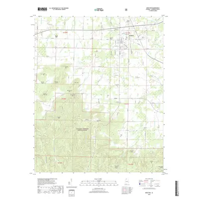
2018 Map of Moulton
USGS Topo · Published 2018About this map
Moulton serves as the focal point of this Lawrence County landscape, situated just north of the expansive William B. Bankhead National Forest. The town's grid is detailed with street names like College St and School St, while local landmarks such as Town Spring and the Moulton Municipal Cem anchor the community's historical geography. To the south, the terrain becomes increasingly complex as the Tennessee Valley Divide passes through the forest.
Find a feature on this map
115 named features on this map. Tap any name to fly to it.
Don’t see what you’re looking for? This feature index may not catch every label — zoom into the map to look around manually.
Map Details
Editions of this 2018 Moulton Map
This is the sole edition of this map. No revisions or reprints were ever made.
Other maps of this area

1935 · Moulton
USGS Topo · 1:24,000

1935 · Upshaw
USGS Topo · 1:24,000

1935 · Danville
USGS Topo · 1:48,000

1935 · Oakville
USGS Topo · 1:24,000

1936 · Caddo
USGS Topo · 1:24,000

1936 · Moulton
USGS Topo · 1:48,000

1936 · Masterson
USGS Topo · 1:24,000

1936 · Hatton
USGS Topo · 1:24,000

1936 · Landersville
USGS Topo · 1:24,000

1938 · Danville
USGS Topo · 1:62,500