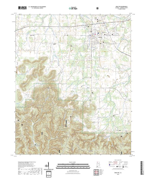
2024 Map of Moulton
USGS Topo · Published 2024About this map
The Lawrence County Courthouse stands as the central landmark of Moulton, marking a landscape where the agricultural flats of Moulton Valley meet the rising elevations of the William B. Bankhead National Forest. This transition is clearly defined by the Tennessee Valley Divide, which separates northern drainages like Sledge Creek from the southern headwaters of the Sipsey Fork of the West Fork Wild and Scenic River. Genealogists will find a high density of burial sites including the Moulton Old City Cem, Milam Campground Cem, and Freeman Tabernacle Cem. The geography is characterized by distinct gaps and peaks such as Pinhook Gap, Suttons Gap, and Buzzard Roost Mtn, illustrating the complex terrain where the Tennessee Valley meets the northern reaches of the Bankhead wilderness.
Find a feature on this map
130 named features on this map. Tap any name to fly to it.
Don’t see what you’re looking for? This feature index may not catch every label — zoom into the map to look around manually.
Map Details
Editions of this 2024 Moulton Map
This is the sole edition of this map. No revisions or reprints were ever made.
Other maps of this area

1935 · Moulton
USGS Topo · 1:24,000

1935 · Upshaw
USGS Topo · 1:24,000

1935 · Danville
USGS Topo · 1:48,000

1935 · Oakville
USGS Topo · 1:24,000

1936 · Caddo
USGS Topo · 1:24,000

1936 · Moulton
USGS Topo · 1:48,000

1936 · Masterson
USGS Topo · 1:24,000

1936 · Hatton
USGS Topo · 1:24,000

1936 · Landersville
USGS Topo · 1:24,000

1938 · Danville
USGS Topo · 1:62,500