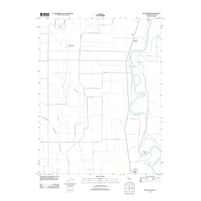
2012 Map of Moulton Weir
USGS Topo · Published 2012About this map
The Sacramento River meanders through this agricultural landscape, defined by an intricate network of water management features including the Moulton Weir and the Colusa Trough. This 2012 survey illustrates the intersection of industrial farming and conservation, with large tracts of the Delevan Natl Wildlife Refuge interspersed among productive fields. Cultural history is anchored in the south at the Colusa Rancheria and Cachil Dehe Rancheria, while small settlements and river access points like Stegeman, Compton Landing, and Boggs Landing dot the riverbanks. The presence of Gunnersfield Ranch Airport and the complex irrigation system of the Provident Central Canal and Central Drain reflect the intensive land use required for California's Central Valley agriculture. This map preserves a record of the river's path through named features like Hamilton Bend before modern developments or shifts in the waterway occur.
Find a feature on this map
34 named features on this map. Tap any name to fly to it.
Don’t see what you’re looking for? This feature index may not catch every label — zoom into the map to look around manually.
Map Details
Editions of this 2012 Moulton Weir Map
This is the sole edition of this map. No revisions or reprints were ever made.
Other maps of this area

1888 · Marysville
USGS Topo · 1:125,000

1891 · Marysville
USGS Topo · 1:125,000

1894 · Marysville
USGS Topo · 1:125,000

1895 · Marysville
USGS Topo · 1:125,000

1906 · Maxwell
USGS Topo · 1:62,500

1907 · Colusa
USGS Topo · 1:62,500

1911 · Sanborn Slough
USGS Topo · 1:31,680

1912 · Butte City
USGS Topo · 1:31,680

1912 · Meridian
USGS Topo · 1:31,680

1917 · Logandale
USGS Topo · 1:31,680