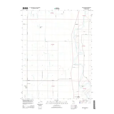
2015 Map of Moulton Weir
USGS Topo · Published 2015About this map
The Sacramento River defines the eastern boundary of this landscape, its winding course marked by hydrological features like Hamilton Bend and the essential infrastructure of the Moulton Weir. This 2015 survey reveals a terrain meticulously managed for water distribution and conservation within the Sacramento Valley. A complex network of irrigation and drainage channels, including the Provident Central Canal, the Colusa Trough, and the Northeast Drain, crisscrosses the agricultural flats. Cultural and civic footprints are visible at the Colusa Rancheria and the settlement of Stegeman, while the western portion of the map is dominated by the Delevan National Wildlife Refuge. Regional aviation is represented by private facilities such as Gunnersfield Ranch Airport and Richter Airport, serving the agricultural operations of this fertile river corridor.
Find a feature on this map
40 named features on this map. Tap any name to fly to it.
Don’t see what you’re looking for? This feature index may not catch every label — zoom into the map to look around manually.
Map Details
Editions of this 2015 Moulton Weir Map
This is the sole edition of this map. No revisions or reprints were ever made.
Other maps of this area

1888 · Marysville
USGS Topo · 1:125,000

1891 · Marysville
USGS Topo · 1:125,000

1894 · Marysville
USGS Topo · 1:125,000

1895 · Marysville
USGS Topo · 1:125,000

1906 · Maxwell
USGS Topo · 1:62,500

1907 · Colusa
USGS Topo · 1:62,500

1911 · Sanborn Slough
USGS Topo · 1:31,680

1912 · Butte City
USGS Topo · 1:31,680

1912 · Meridian
USGS Topo · 1:31,680

1917 · Logandale
USGS Topo · 1:31,680