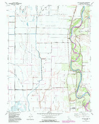
1991 Map of Moulton Weir
USGS Topo · Published 1995About this map
The Sacramento River defines the eastern boundary of this agricultural landscape in Colusa County, where complex water management systems like the Colusa Trough, Moulton Weir, and numerous canals dominate the terrain. This 1991 revision, based on earlier mid-century data, captures a region shaped by large land holdings like the Larkins Childrens Rancho and Jimeno grants. The map documents specialized land uses including the Delevan National Wildlife Refuge and the Colusa (Cachil Dehe) Rancheria, illustrating the persistence of both conservation and indigenous heritage. Evidence of the area's river-dependent history is visible at the Compton Landing (Site) and the winding Hamilton Bend, while recreational interests are marked by the Green Mallard Duck Club and Bell Outing Gun Club. Transport remains primarily tied to the grid of country roads like Maxwell Road, though an Old Railroad Grade hints at retired infrastructure.
Find a feature on this map
34 named features on this map. Tap any name to fly to it.
Don’t see what you’re looking for? This feature index may not catch every label — zoom into the map to look around manually.
Map Details
Editions of this 1991 Moulton Weir Map
This is the sole edition of this map. No revisions or reprints were ever made.
Other maps of this area

1888 · Marysville
USGS Topo · 1:125,000

1891 · Marysville
USGS Topo · 1:125,000

1894 · Marysville
USGS Topo · 1:125,000

1895 · Marysville
USGS Topo · 1:125,000

1906 · Maxwell
USGS Topo · 1:62,500

1907 · Colusa
USGS Topo · 1:62,500

1911 · Sanborn Slough
USGS Topo · 1:31,680

1912 · Butte City
USGS Topo · 1:31,680

1912 · Meridian
USGS Topo · 1:31,680

1917 · Logandale
USGS Topo · 1:31,680