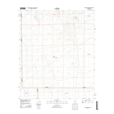
2013 Map of Mound Springs
USGS Topo · Published 2013About this map
Tularosa Valley defines the expansive basin geography of this high-desert region, where the intersection of four different county lines—Socorro, Lincoln, Sierra, and Otero—marks a complex administrative boundary. The landscape is characterized by its drainage and water management features, critical for life in this arid environment. The intermittent course of Salt Cr meanders across the valley floor, while a network of water catchments including Red Tank, Lone Cedar Tank, and Upper Dog Town Tank punctuate the terrain. Red Hill stands as a notable relief feature in the northeast, providing a vantage point over the namesake Mound Springs. This 2013 survey provides a detailed look at the water infrastructure and topography of a sparsely populated section of southern New Mexico where cattle ranching and range management remain central to the land's utility.
Find a feature on this map
11 named features on this map. Tap any name to fly to it.
Don’t see what you’re looking for? This feature index may not catch every label — zoom into the map to look around manually.
Map Details
Editions of this 2013 Mound Springs Map
This is the sole edition of this map. No revisions or reprints were ever made.
Other maps of this area

1916 · Tularosa
USGS Topo · 1:125,000

1918 · Oscura Peak
USGS Topo · 1:125,000

1947 · Three Rivers
USGS Topo · 1:62,500

1947 · Capitol Peak
USGS Topo · 1:62,500

1948 · Chihuahua Ranch
USGS Topo · 1:62,500

1948 · Mockingbird Gap
USGS Topo · 1:62,500

1954 · Tularosa
USGS Topo · 1:250,000

1958 · Tularosa
USGS Topo · 1:250,000
1981 · Bull Gap SW
USGS Topo · 1:24,000

1981 · Tularosa
USGS Topo · 1:100,000