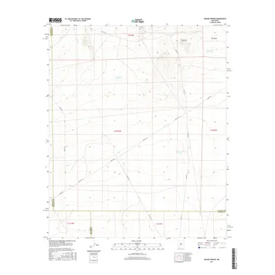
2017 Map of Mound Springs
USGS Topo · Published 2017About this map
Mound Springs serves as a vital water source in this arid landscape along the border of Lincoln and Otero counties. The 2017 survey reveals an environment defined by limited water and vast ranching or military utility infrastructure, evidenced by features such as Red Tank, Lone Cedar Tank, and Upper Dog Town Tank. The presence of several White Sands Missile Range routes, including Wsmr P RT 8 and Wsmr P RT 9, indicates the area's modern role within a restricted government landscape. Topographical interest is centered around Red Hill in the northeast, while the ephemeral Salt Cr winds through the central and southern portions of the map, tracing the natural drainage patterns that have likely dictated movement through this region for generations.
Find a feature on this map
21 named features on this map. Tap any name to fly to it.
Don’t see what you’re looking for? This feature index may not catch every label — zoom into the map to look around manually.
Map Details
Editions of this 2017 Mound Springs Map
This is the sole edition of this map. No revisions or reprints were ever made.
Other maps of this area

1916 · Tularosa
USGS Topo · 1:125,000

1918 · Oscura Peak
USGS Topo · 1:125,000

1947 · Three Rivers
USGS Topo · 1:62,500

1947 · Capitol Peak
USGS Topo · 1:62,500

1948 · Chihuahua Ranch
USGS Topo · 1:62,500

1948 · Mockingbird Gap
USGS Topo · 1:62,500

1954 · Tularosa
USGS Topo · 1:250,000

1958 · Tularosa
USGS Topo · 1:250,000
1981 · Bull Gap SW
USGS Topo · 1:24,000

1981 · Tularosa
USGS Topo · 1:100,000