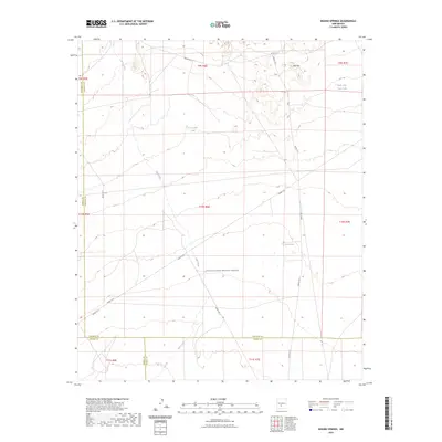
2023 Map of Mound Springs
USGS Topo · Published 2023About this map
White Sands Missile Range dominates this portion of the Tularosa Basin, where the arid landscape is defined by drainage systems and essential water catchments. The ephemeral Salt Creek winds through the center of the sheet, providing a primary hydrological feature in an area marked by high-desert terrain. Strategic water sources like Lone Cedar Tank and Upper Dog Town Tank reflect the importance of water management in this sparsely populated environment, while the namesake Mound Springs serves as a notable landmark within the military reservation boundaries. To the north, the topographic relief of Red Hill rises above the basin floor, providing a rare point of elevation amidst the desert flats. This survey illustrates the convergence of five major county lines including Socorro, Sierra, and Otero, highlighting a remote geographical nexus at the heart of New Mexico's interior.
Find a feature on this map
25 named features on this map. Tap any name to fly to it.
Don’t see what you’re looking for? This feature index may not catch every label — zoom into the map to look around manually.
Map Details
Editions of this 2023 Mound Springs Map
This is the sole edition of this map. No revisions or reprints were ever made.
Other maps of this area

1916 · Tularosa
USGS Topo · 1:125,000

1918 · Oscura Peak
USGS Topo · 1:125,000

1947 · Three Rivers
USGS Topo · 1:62,500

1947 · Capitol Peak
USGS Topo · 1:62,500

1948 · Chihuahua Ranch
USGS Topo · 1:62,500

1948 · Mockingbird Gap
USGS Topo · 1:62,500

1954 · Tularosa
USGS Topo · 1:250,000

1958 · Tularosa
USGS Topo · 1:250,000
1981 · Bull Gap SW
USGS Topo · 1:24,000

1981 · Tularosa
USGS Topo · 1:100,000