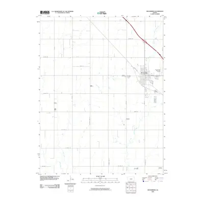
2009 Map of Moundridge
USGS Topo · Published 2009About this map
Moundridge serves as the central hub of this agricultural and energy landscape in McPherson County. The town's layout is defined by a grid of residential streets like Cole St and 4th St, bordered to the east by the Moundridge Municipal Airfield. The surrounding prairie is bisected by several watercourses, most notably Black Kettle Creek and Sand Creek, which wind through a patchwork of section-line roads with names reflecting indigenous and local history, such as Arapaho Rd and Cherokee Rd.
Find a feature on this map
33 named features on this map. Tap any name to fly to it.
Don’t see what you’re looking for? This feature index may not catch every label — zoom into the map to look around manually.
Map Details
Editions of this 2009 Moundridge Map
This is the sole edition of this map. No revisions or reprints were ever made.
Other maps of this area

1889 · Newton
USGS Topo · 1:125,000

1891 · Hutchinson
USGS Topo · 1:125,000

1893 · Hutchinson
USGS Topo · 1:125,000

1894 · Newton
USGS Topo · 1:125,000

1955 · Hutchinson
USGS Topo · 1:250,000

1959 · Hutchinson
USGS Topo · 1:250,000
1959 · Zimmerdale
USGS Topo · 1:24,000
1959 · Halstead
USGS Topo · 1:24,000
1959 · Burrton
USGS Topo · 1:24,000

1965 · Mc Pherson South
USGS Topo · 1:24,000